SATELLITE EARTH OBSERVATIONS AND COPERNICUS
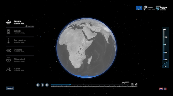
Satellite-based Earth Observations help us to improve our understanding about the changing climate and about the state of the planet. With continuous, regular, global accurate measurements of different parameters such as sea surface height anomalies, sea surface temperatures, salinity, chlorophyll, scientists can better understand how ocean currents are evolving and forecast possible future scenarios.
Copernicus, the world’s largest Earth Observation programme co-funded by the European Union and ESA, aims at monitoring our planet and its environment, providing civil security for European citizens and increasing resilience for Europe.
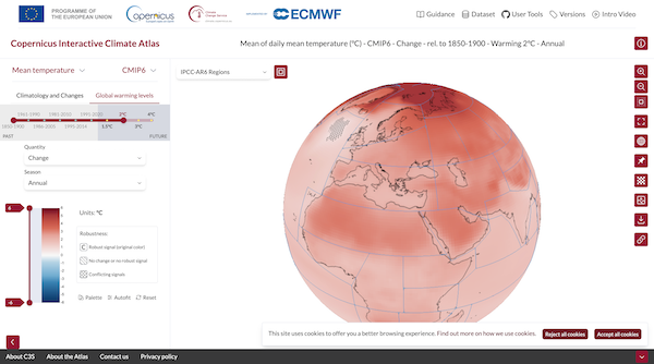
For example, the Copernicus Marine Environment Monitoring Service provides estimates about the oceans and reports about their status (see https://marine.copernicus.eu/osr9-summary/flipbook/ ) while the Copernicus Climate Change Service integrates long time data series from different sources to monitor the evolution of the so-called Essential Climate Variables. This Service also provides authoritative reports about the State of the Climate, informing key decisions on how to mitigate climate change and how to drive effective adaptation measures.
The open and free data from the Copernicus Sentinel satellite missions are used in manifold applications such as biodiversity conservation, precision farming, infrastructures stability monitoring, emergency response, hazards risk assessment, natural resources management. From public administrations to civil society, from scientists to industry, boosting innovation and the economy, users make use of these data to take decisions at different levels. You can explore at this link a wealth of examples showing how Copernicus benefits citizens in Europe and beyond.